Marine Barometer: Accurate Atmospheric Pressure for Mariners
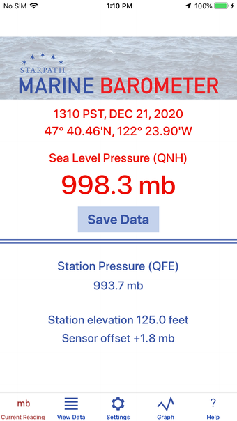
Marine Barometer is a specialized barometer sensor interface designed specifically for mariners who rely on accurate atmospheric pressure for weather routing and weather map evaluation. This iPhone app allows users to manually save pressure readings along with latitude, longitude, and time information. Additionally, if a sensor offset has been applied, it is also stored with each recorded pressure. The recorded pressures can be easily transferred to a vessel's printed logbook at the user's convenience.
To ensure accuracy, the app accesses the GPS sensor for latitude and longitude information, while the elevation above sea level must be entered manually. This is because the elevation values from the GPS are not precise enough for the intended marine application. The concept of sea level pressure is explained within the app, along with instructions on how to check the calibration of the sensor. Users can also apply a sensor offset if necessary.
Marine Barometer provides links to sources of accurate sea level pressure and elevation for use on land. The main pressure display can be set to millibars (mb), hectoPascals (hPa), inches of mercury, millimeters of mercury, or kiloPascals. However, the sensor calibration must be set using millibar units, as the primary reference pressures for calibration are in mb.
For mariners interested in learning more about the tactical use of pressure for weather forecasting and weather map evaluation, the app offers reference links and discounts on barometer-related reference books.